


Voting District 144, Whatcom County, Washington
About
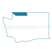
Outline

Summary
| Unique Area Identifier | 689971 |
| Name | Voting District 144 |
| County | Whatcom County |
| State | Washington |
| Area (square miles) | 88.24 |
| Land Area (square miles) | 87.24 |
| Water Area (square miles) | 1.01 |
| % of Land Area | 98.86 |
| % of Water Area | 1.14 |
| Latitude of the Internal Point | 48.70770500 |
| Longtitude of the Internal Point | -122.10963810 |
Maps


Graphs
Select a template below for downloading or customizing gragh for Voting District 144, Whatcom County, Washington


Neighbors
Neighoring Voting District (by Name) Neighboring Voting District on the Map
- Voting District 138, Whatcom County, WA
- Voting District 142, Whatcom County, WA
- Voting District 143, Whatcom County, WA
- Voting District 145, Whatcom County, WA
- Voting District 152, Whatcom County, WA
- Voting District 153, Whatcom County, WA
- Alder Voting District, Skagit County, WA
- Minkler Voting District, Skagit County, WA
- Mount Baker National Forest Leg 42, Whatcom County, WA
- Prairie Voting District, Skagit County, WA
Top 10 Neighboring County Subdivision (by Population) Neighboring County Subdivision on the Map
- Bellingham CCD, Whatcom County, WA (110,614)
- East Whatcom CCD, Whatcom County, WA (7,895)
- Upper Samish River CCD, Skagit County, WA (4,071)
- Lyman-Hamilton CCD, Skagit County, WA (2,821)
Top 10 Neighboring Place (by Population) Neighboring Place on the Map
Top 10 Neighboring Unified School District (by Population) Neighboring Unified School District on the Map
- Bellingham School District, WA (102,121)
- Sedro-Woolley School District, WA (26,212)
- Mount Baker School District, WA (14,352)
Top 10 Neighboring State Legislative District Lower Chamber (by Population) Neighboring State Legislative District Lower Chamber on the Map
- State House District 42, WA (146,619)
- State House District 39, WA (143,154)
- State House District 40, WA (138,925)
Top 10 Neighboring State Legislative District Upper Chamber (by Population) Neighboring State Legislative District Upper Chamber on the Map
- State Senate District 42, WA (146,619)
- State Senate District 39, WA (143,154)
- State Senate District 40, WA (138,925)
Top 10 Neighboring 111th Congressional District (by Population) Neighboring 111th Congressional District on the Map
Top 10 Neighboring Census Tract (by Population) Neighboring Census Tract on the Map
- Census Tract 8.06, Whatcom County, WA (7,983)
- Census Tract 101, Whatcom County, WA (7,895)
- Census Tract 9509, Skagit County, WA (4,071)
- Census Tract 9510, Skagit County, WA (2,821)